3rd GEOINT and Open Source Analytics Summit
September 18-19, 2018 | Spire Events Center, Washington D.C.
The 2018 GEOINT and Open Source Analytics Summit will focus on techniques and resources aimed at integrating open source technologies into today’s GEOINT landscape. This educational summit will engage US military commands, government agencies, and technology providers in a town-hall forum to highlight the impact of open source data combined with sensitive information to develop a holistic GEOINT picture.
__________________________________________________
* Weather Notice/ The GEOINT & Open Source Analytics Summit will occur as scheduled. Per the National Weather Service, effects from Hurricane Florence will be south of the Washington DC metro area. We will continue to monitor developments as they relate to Florence and update attendees if there is a need.
________________________________________

- Christy Monaco, Director, Office of Ventures and Innovation, NGA
______________________________________________________________________
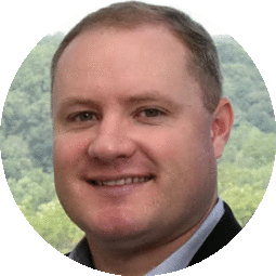
- Chris Rasmussen, Program Manager, Unclassified GEOINT Pathfinder, NGA
______________________________________________________________________
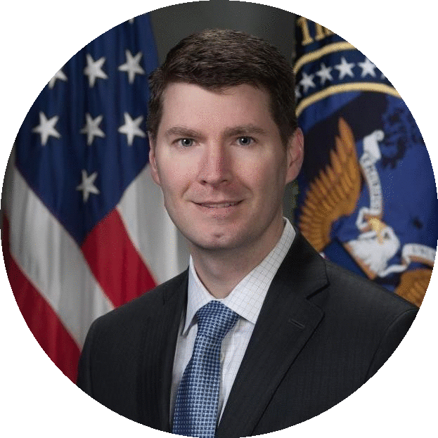
- Pete Muend, Commercial GEOINT Director, National Reconnaissance Office
______________________________________________________________________

- CAPT Patrick Schreiber, USCG, Commanding Officer, Coast Guard Intelligence Coordination Center (ICC)
______________________________________________________________________
- COL David Robinson, USA, Army Service Lead, DIUx
______________________________________________________________________
Additional Speakers:
- LTC Shannon Helberg, USA Commander, Army GEOINT Battalion, National Ground Intelligence Center
- David Wrubel, Chief, Integrated Analysis and Methods Division, DIA
- Victor Robles, Chief, Army OSINT Program, HQDA G-2
________________________________________________________________________________________________________
Why Attend?
-
- This educational summit will enable the Intelligence Community, military intelligence organizations and industry partners to come together in a collaborative forum to encourage honest dialogue to address the technical vulnerabilities of the Intelligence Community focusing specifically on GEOINT.
-
- In today’s technological era, the IC has been seeing increased importance and reliance on the ability to harness and exploit open source data to enhance GEOINT. This forum will discuss the efforts to couple commercial open source data with classified information and how this combination enhances the quality of GEOINT brought to key decision-makers. The main objective of this year’s discussion will be integrating this open source information and effectively exploiting it in a timely manner.
-
- Overall, this summit will feature senior level discussions of the latest efforts by government agencies and organizations to utilize geospatial and open source data for critical missions. Such a dialogue in a non-attributed setting, will allow for solution providers and thought-leaders to join together in vital discussion regarding the advancements and progress of GEOINT resources and tools.
- Overall, this summit will feature senior level discussions of the latest efforts by government agencies and organizations to utilize geospatial and open source data for critical missions. Such a dialogue in a non-attributed setting, will allow for solution providers and thought-leaders to join together in vital discussion regarding the advancements and progress of GEOINT resources and tools.
_______________________________________________________________________________________________________
Exhibiting & Sponsorship
- This summit offers several distinct opportunities for a few organizations to demonstrate their technologies or solutions that address the summit subject matter, or to partake in a thought leadership role.
- If you are an organization that would like to learn more about how you can be involved, please visit us at the Sponsors and Supporters Page.
- -Modernizing GEOINT by applying big data computing and machine learning resources to introduce data points including classified and unclassified sources
- -Harnessing the direction of NGA’s initiative of augmentation, artificial intelligence, and automation for increased effectiveness
- -Collecting and creating operational-tactical imagery, elevation data, and geospatial information for mission success
- -Incorporating AI into the geospatial realm for increased automation and easier identification of targets
- -Efforts toward applying a unified GEOINT platform to utilize tools, algorithms, and capabilities into a data-centric exploitation model
- -Working to employ a joint effort combination between humans and computers to expand data volumes allowing for accurate GEOINT exploitation
________________________________________________________________________________________________________
At our Summit You Will Have the Ability to
- Gain Education & Insight: Walk away with knowledge gained from our senior level speakers on some of the complex challenges facing intelligence officers and analysts.
- Build Partnerships: The agenda is designed to allow for ample networking opportunities and the ability to discover some the latest technologies helping process, exploit, and disseminate big data.
- Influence: Help foster ideas! Share your own insight and knowledge during our interactive sessions. All attendees are given the opportunity to address our speaker faculty with their questions or comments and will receive a pre-summit questionnaire for precise questions and subject matters you would like our speakers to address.
________________________________________________________________________________________________________
Operating Guidance for Government Attendees
- DSI’s summit directly supports DoD, Military Services, and federal priorities by providing a conduit for officials to efficiently reach audiences outside of their respective offices that directly impact their department’s mission success, at no charge to the government, and in an efficient expenditure of time.
- DSI’s summit will provide a forum to address and improve internal and external initiatives, meet with and hear from partner organizations, disseminate vital capability requirements to industry, increase visibility within the larger community, and generally support their mission.
- The summit is open and complimentary to all DoD and Federal employees and is considered an educational and training forum.
- (Industry and academia members are charged a fee for admission)
- Summit is CLOSED TO PRESS / NO RECORDINGS
________________________________________________________________________________________________________________
- Participating Organizations at Last Year’s Summit Included
- NGA, US Army Geospatial Center, Adobe, AECOM, Aerojet Rocketdyne, AFRL/ Information, Directorate, AG/RPD, US Department of State, Airline Ambassadors International, BAE Systems, Bloomberg L.P., Blue Compass, LC, Booz Allen Hamilton, Boundless, Cal Poly Office of Research & Economic Development, Carahsoft, CCRi, CollabraSpace, Compass, Inc., Concurrent Technologies Corporation, Continental Mapping, Consultants, Crunchy Data, CSRA, DAn Solutions, Inc., DeepSequence, DellEMC, DHS, DIA, Diffeo, Digital Reasoning, DigitalGlobe, Directorate of Nuclear Treaty Monitoring AFTAC/TTX, DOE, Dun & Bradstreet, East View Geospatial, Envitia Inc, FEMA, First Mile Geo, General Dynamics IT, General Dynamics Mission Systems, Geographic Services, Harris Corporation, IBM, INA Solutions, Inc., Innovative Decisions, Inc., In-Q-Tel, Institute of World Politics, Janus Research Group, Jefferson Institute, KEYW Corporation, Inc., Leidos, Lockheed Martin, MacAulay Brown, Inc., MapLarge, MapR Technologies, Marine Corps Intelligence Activity, MarkLogic, Mathworks, MDA Information Systems LLC, Modus Operandi, New World Solutions, LLC, NIST, Noblis NSP, Northrop Grumman, Northrop Grumman Mission Systems, Novetta, Oak Wood Controls, OG Systems, Open Source Enterprise, Organon Advisors, PAR Government, PixElement, Planet, PlanetRisk, Praescient Analytics, Quaestor Federal Consulting, RadiantBlue Technologies, RG I, SAIC, SAS, SDL Government , Sentrana Inc, Software AG Government Solutions, The HumanGeo Group, The Radiant Group, The Sanbron Map Company, U.S. Navy, United States Geological Survey, Ursa Space Systems, UrtheCast, US Army, , Vencore, 377 Omega, Inc, and more!

